New England's UAV LiDAR Specialists
Highly precise and accurate georeferenced point clouds are created in a fraction of the time of traditional surveying methods with UAV LiDAR (unmanned aerial vehicle with a light detection and ranging sensor).
Bathymetric LiDAR service also available
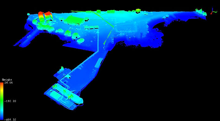
Dragon Cement Shore Facility - Rockland Harbor

Applications:
-Site elevation mapping for project bidding
-watershed topography
-digital terrain models
-carbon sequestration
- biomass calculations
-wastewater treatment facilities
-erosion analysis
-energy corridor mapping
-vegetation encroachment
-construction
-precision agriculture


LiDAR Sensor: 250,000 safe laser pulses/second are sent out, and using the constant velocity of light, their returns are measured and recorded to create a high-fidelity 3D representation of the area being scanned.
These measurements combined with dual GNSS (global satellite navigation system) antennas mounted to the UAV, a GNSS base station, and the LiDAR sensor's IMU (inertial measurement unit) georeferenced point clouds are generated to be imported into all types of professional surveying, engineering, and building software.
Camden Harbor Rising Sea Level Studies


LiDAR Point Cloud (+/- 1/10th ft) with photo-texture colorization. Camden Harbor Park scanned at extreme low-tide to generate rising sea level simulations for engineering and redevelopment which prioritizes preserving the intertidal habitat.
Private Property Mapping for New Construction
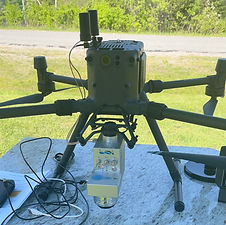
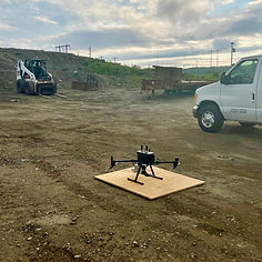
M300 RTK drone RTK, nearly 1-hr flight time per battery set, self-heating batteries for winter data acquisition. Capable of scanning 500 acres per diem
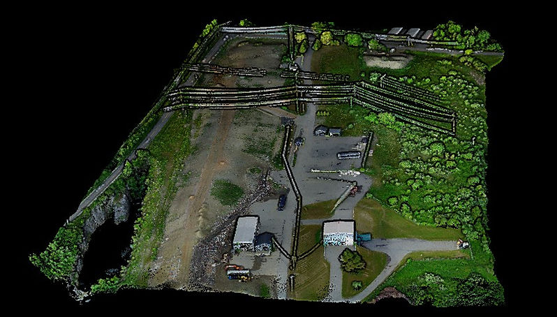
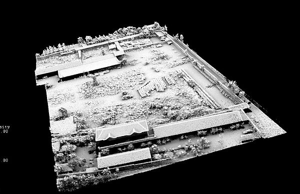
Rockland Transfer Station - Facilities and Mound Volumetrics
(EDL enhanced shadow view)
Georeferenced point clouds and images: WGS84, NAD83, NADV83 and easily convertible to other formats
Deliverables compatible with AutoCAD, ArcGIS, and all other major BIM software
Camden Wastewater Facility - Redevelopment

Put the power of aerial mapping into your project.
What can we do for for you?